Map of the Inca Empire
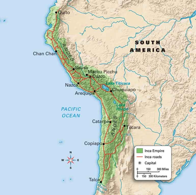
This map of the ancient Inca empire shows unique systems of roads, lakes, cities, and mountains. The Inca empire had a very complex series of roads, as shown by the red lines on the map below. The capitol of the Inca empire was called Cuzco. Below Cuzco was a lake named Lake Titicaca. This entire civilization lay on the Andes Mountains, the reason that they need to use terrace farming in order to get food. The Inca civilization was in South America, next to the Pacific ocean. Currently, the location where the Inca civilization was is now the southern border of the Columbia and stretches into central Chile.